It's been a great trip, but it's definitely time to head for home. (Even introverts get lonely after a while).
My original plan was to head North today and loop through Gunnison, CO on my way to Colorado Springs and up to I-70. But Snow... The road north is snowy and icy this morning - maybe even closed. The motor coach bus service into Silverton was canceled yesterday because of it... So, I think I will head East this morning through Pagosa Springs and on into the Pueblo CO area, then North to I-70 to avoid the snow. It's like a local guy told me a couple of days ago - "Just when you start to take the mountains for granted, they get your attention.". True.
I didn't: do much deep thinking or writing on this trip - thought I would.
I did: practice my guitar and mando, watched almost no TV (caught a little playoff hockey & basketball) , read a couple of books, did a ton of hiking, caught up on my scripture memory, wrote in this blog, drove a ton of miles and had a great, relaxing time.
So now it's east through Omaha to see Calvin & Liz and then back home to Hanover, MI....
See ya.
Spi
Thursday, May 19, 2011
The San Juan Mountains or Durango to Silverton on the Steam Train
Snowing in the San Juans, in May... I guess that is not an unusual event. A guy in Silverton told me that May is a schizophrenic month - you never know about the weather or the tourists.
The Durango to Silverton narrow gauge train line goes somewhat parallel to the San Juan Skyway up into the heart of the San Juan Mountain range from Durango to Silverton. The Railroad goes up the Animas River canyon, in some places clinging to its very walls.
Silverton is a very small western mountain town that would like to still be mining (the last operation closed in the early 1990s), but is only there now for tourism. It at 9130 ft above sea level, so when it started to snow, I should not have been surprised.


The Durango to Silverton narrow gauge train line goes somewhat parallel to the San Juan Skyway up into the heart of the San Juan Mountain range from Durango to Silverton. The Railroad goes up the Animas River canyon, in some places clinging to its very walls.
 |
| My view from Coach Car 2 |


Durango, CO
I ended up spending two very nice days in Durango. It turned out to be my favorite locale for this trip.What did I like: an active Steam train line with tons of history, a cool Western feel - but not excessively touristy, mountains looming over the city in all directions - with hiking trails, a really nice river through the city with a river walk along its length, a really nice downtown with nice eateries and places to look into, a college in town, big emphasis on biking (when there's no snow). It's a small enough, yet big enough city.
 |
| Historic Downtown Hotel |
 |
| The Durango to Silverton Narrow Gauge Train leaving Downtown Durango |
 |
| On the Animas River Walk in Durango |
 |
| Looking out to the mountains behind my Motel |
Chama, Chama, Chama...
Last place in New Mexico - Chama. Up and over the mountains, through Chama and onto Durango, CO for the last local of my trip out west.
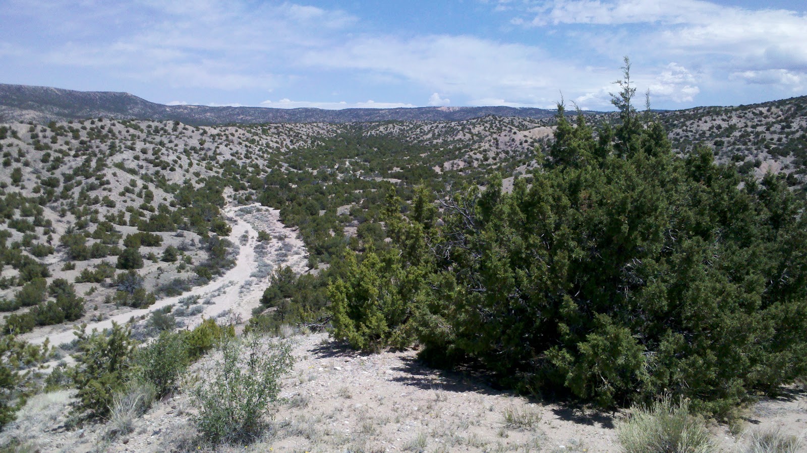
Here are the mountains just East of Chama - with a bunch of snow drifts left from winter...


This was the highest point of my trip between Taos and Durango, but it was not labeled as the "Continental Divide", so I looked it up. I figured the Continental Divide ran along the highest peaks of the Rockies, but that's not necessarily so, it is the line which demarcates the Atlantic and Pacific watersheds. So the line follows the break point for where the water flows, east or west. Turns out that line was a number of miles down the road towards Durango yet, on a large flat plateau between the Eastern and Western prevailing mountain ranges. These images above are part of the Eastern range. Durango is nestled in the Western range.
Sunday, May 15, 2011
Cimarron Canyon State Park
Here is my beautiful place for the day! I found a great trail (the Maverick Trail) up into the Sangre De Christo mountains in this State Park. A little over a mile short of Black Jack peak I found a perfect little mountain stream to sit by and eat my lunch. Most of the park focuses on a little stream running 13 miles or so along the main park road. Trout season was on, so most of the visitors seemed to be focusing on fishing. I had this mountain trail all to myself for about 4 hours.


Bobcat Pass on the Enchanted Circle Drive above Taos
The Enchanted Circle drive leaves Taos and goes 98 miles around one of the largest peaks in the Sangre De Christos mountain range - Wheeler Peak. The highest point on the journey, about half way around is Bobcat Pass at about 9800 ft. above sea level. The view was spectacular from the pass area. Unfortunately, all the land around the pass is private and there was no place to hike around. I would have loved to hike into one of these alpine meadows.
Just down the road from the pass was this little beaver dam and house. Way up here in the mountains this little beaver made his home. No wonder there were mountain man trappers in the Rockies (think Jeremiah Johnson).
 |
| The View from Bobcat Pass |
 |
| The Beaver's Dam |
 |
| The Beaver's Home |
 |
| The whole pond |
Saturday, May 14, 2011
The Rio Grande Gorge at Taos, NM
I drove across this bridge (back and forth), but I wasn't one of those brave souls to walk out there and get some pictures. I was down beside the Rio Grande yesterday, upstream too, and it looks a lot bigger from that perspective than from the top of this gorge.
 |
| The Rio Grande Gorge Bridge at Taos, NM |
 |
| Looking down into the Gorge |
On the High Road to Taos
Going from Los Alamos to Taos you have two basic options, the Low road and the High road. The high road goes up into the mountains and passes through multiple little towns and the Carson National Forest. The low road is the fast, divided highway option. Of course, I took the high road.
 |
| The Anderson Overlook on 502 coming down out of Los Alamos |
 |
| Scenic overlook on the 76, the High Road to Taos |
 |
| Looking at the snow on peaks of the Sangre De Christos mountains from Los Truchas, NM |
Valles Calderas in the Jemez Mountains above Los Alamos, NM
Just when I think I've found a really beautiful place in the mountains, I find a prettier one...
Here is where I spend a few hours this morning (actually perched on the extra large volcanic boulder on the right of the four in this photo).
Here is where I spend a few hours this morning (actually perched on the extra large volcanic boulder on the right of the four in this photo).
 |
| Valles Calderas in the Jemez Mountains |
Friday, May 13, 2011
Bandelier National Monument, Los Alamos, NM
The Jemez mountains surround Los Alamos. In fact, Los Alamos is at 6000 ft in the Jemez Mountains. Driving up to it is really a trip. Inside the Jemez mountains is a National Monument called Bandelier which houses lots of Ancient Pueblo ruins and trails.
This morning I hiked the 1.2 mile main loop trail which takes in most of the historic architectural sites. Then I hiked the 5.0 mile (round trip) Falls Trail which goes from the Canyon Rim at the Visitor Center, down the Canyon to the Rio Grande river (700 ft total drop). Wow, what a workout and what a beautiful set of hikes. I ended up with over 250 pictures and legs so sore...
This morning I hiked the 1.2 mile main loop trail which takes in most of the historic architectural sites. Then I hiked the 5.0 mile (round trip) Falls Trail which goes from the Canyon Rim at the Visitor Center, down the Canyon to the Rio Grande river (700 ft total drop). Wow, what a workout and what a beautiful set of hikes. I ended up with over 250 pictures and legs so sore...
 |
| The Jemez Mountains above Bandelier, East of Los Alamos NM |
 |
| Ancient People Ruins - Bandelier National Monument |
 |
| Me and a monster Ponderosa Pine |
 |
| 1/2 way down the Falls Trail (yes, the Rio Grande is way out there at the end of the Canyon) |
 |
| Over the 1st Water Fall, It's a BIG drop behind me... |
 |
| The Rio Grande River |
NM 3 and Villanueva State Park
My waitress at the Mid-Point Cafe was great. I told her where I was headed and she wiped out a NM map and described to me the three basic paths to get from I-40 in NM to Santa Fe. She showed me NM 3 and I knew that was the path for me... So it was Good-Bye Route 66 and North into New Mexico.
NM 3 is a 2-lane road less traveled between I-40 and I-25. I creeps into the Sangre De Christo mountain range at its Southern most edge. About half way there is a little backwaters town called Villanueva and an adjoining State Park. The town reminded me of a Mexican Hanover - except no Gas Station - only a market about 1/4 the size of the Hanover market.
The State Park was great. It had a Overlook Path trail that climber .6 miles up to the peak of the mountain overlooking the Pecos River and out North across the Sangre De Christo mountain range. So even though I hadn't planned on seeing this range until the Taos part of my journey, I got an early treat. Here is one of the views from the top of the mountain looking North...
I had my lunch on top of the mountain.
 |
| NM 3 North |
 |
| The Miata |
The State Park was great. It had a Overlook Path trail that climber .6 miles up to the peak of the mountain overlooking the Pecos River and out North across the Sangre De Christo mountain range. So even though I hadn't planned on seeing this range until the Taos part of my journey, I got an early treat. Here is one of the views from the top of the mountain looking North...
 |
| Looking North into the Sangre De Christo Mountain Range |
Larry and the Mid-Point Cafe in Adrian, Texas
On Wednesday morning I left Amarillo (TX) on my way West. I planned to stop in Adrian Texas which is the official half way point between Chicago and Los Angeles on Route 66.

Sure enough, there it was. And the Mid-Point cafe was right behind me, so I went in for breakfast. That's where I met Larry. Larry is about 10 years older than me, served in Vietnam (with the 101st Airborne), was born and raised in Adrian Texas, has two new knees and a new hip joint and still drives a bus for the local school district. Our tables were adjacent and we ate our breakfasts and had a running conversation. Wonderful morning, I know quite a bit more about the Texas panhandle than I did at the start of this trip.
I bought some postcards and then went to the Post Office a few doors down to mail them. The post lady said "I know you. The owner of the Cafe was just in here and said you were in the Cafe talking to Larry." I love Small Town America!

Main Street, Adrian, TX

Wednesday, May 11, 2011

Galena Historical Museum
What really made Galena interesting was meeting an 80 year old resident who had just opened the local Historical Museum (right on Main Street). This was an old Railroad depot that they moved to main street and restored to be a museum.
He gave me the town history, showed me historical paintings from the local artist and took me in the back where he was repairing the museum's model T... He could have talked all day.


He gave me the town history, showed me historical paintings from the local artist and took me in the back where he was repairing the museum's model T... He could have talked all day.


Favorite stop so far... Galena, Kansas.
Route 66 comes in different flavors. Some stretches are late - from the 50s, 60s and later and are 4 lane divided highways - pretty modern. Some stretches have been ripped up and are gone forever. Some rare stretches hark back to the 20s and 30s - two lane roads with lots of curves and character - perfect for handling model T traffic, but long past their prime.
Going into, through and out-of Galena Kansas was vintage, ancient Route 66.
Here was Route 66 crossing from Missouri into Kansas just before Route 66:
 And the road into and through Galena:


Going into, through and out-of Galena Kansas was vintage, ancient Route 66.
Here was Route 66 crossing from Missouri into Kansas just before Route 66:


Subscribe to:
Comments (Atom)